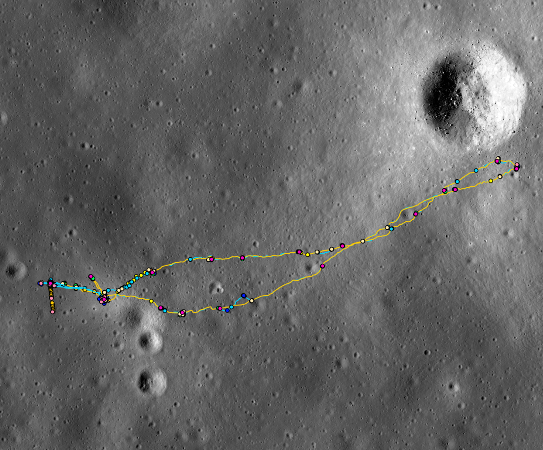
The LROC Apollo mapping group released its Apollo 14 temporal traverse database for download! This mapping effort examined Apollo-era data in the context of high-resolution LROC NAC images to track the movements of Commander Alan Shepard and Lunar Module Pilot Ed Mitchell. The dataset includes the time-stamped locations of astronaut movements, photograph acquisition points, sample collection sites, and temporary resting positions of geology tools for each extravehicular activity (EVA) and the station and deployed scientific equipment locations for that mission. These data are united with the mission dialogue by the "detailed transcripts," spreadsheets consisting of the dialogue for each EVA, and additional columns that contain the mapping information. A complete list of released files with descriptions can be found below.
To view these data interactively online, visit the Apollo 14 spatio-temporal mapping site. To download the data, visit the Apollo 14 data page!
Read more about the Apollo 14 mission:
LROC’s First Look at the Apollo Landing Sites
Trail of Discovery at Fra Mauro
On the rim!
Apollo 14 Fiftieth Anniversary!
Released files ("?" denotes a placeholder for the EVA number):
APOLLO_14_STATIONS: Shapefile of station locations for the mission.
APOLLO_14_EQUIPMENT: Shapefile containing the mapped locations of equipment deployed during the mission.
APOLLO_14-?_CDR_PTS: Shapefile containing the commander's mapped locations during EVA ? of the mission.
APOLLO_14-?_LMP_PTS: Shapefile containing the lunar module pilot's mapped locations during EVA ? of the mission.
APOLLO_14-?_CDR_PATHS: Shapefile containing the commander's mapped traverse paths during EVA ? of the mission.
APOLLO_14-?_LMP_PATHS: Shapefile containing the lunar module pilot's mapped traverse paths during EVA ? of the mission.
APOLLO_14-?_HBLADS: Shapefile containing the mapped locations of the Hasselblad camera photographs taken during EVA ? of the mission.
APOLLO_14-2_ALSCC: Shapefile containing the mapped locations of the Apollo Lunar Surface Close-up Camera (ALSCC) photographs taken during the mission (taken on EVA 2 only).
APOLLO_14-?_SAMPLES: Shapefile containing the mapped locations of the geology samples collected during EVA ? of the mission.
APOLLO_14-?_TOOLS: Shapefile containing the mapped locations of geology tools placed on the lunar surface during EVA ? of the mission.
APOLLO_14-?_DETAILED_TRANSCRIPT: CSV file of the mission dialogue for EVA ? of the mission with associated mapping information (CDR and LMP movements, Hasselblad and ALSCC photography, and sample collection).
Published by Victoria Roseborough on 22 May 2025