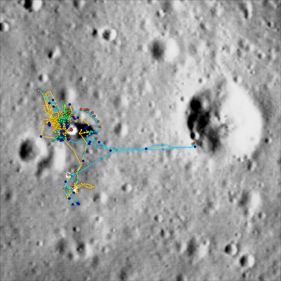
The LROC Apollo mapping group released its Apollo 11 and 12 temporal traverse database for download! This mapping effort examined Apollo-era data in the context of high-resolution LROC NAC images to track the movements of Commander Neil Armstrong and Lunar Module Pilot Buzz Aldrin (Apollo 11) and Commander Pete Conrad and Lunar Module Pilot Al Bean (Apollo 12). The dataset includes the time-stamped locations of astronaut movements, photograph acquisition points, sample collection sites, and temporary resting positions of geology tools for each extravehicular activity (EVA), as well as the station and deployed scientific equipment locations for that mission. These data are united with the mission dialogue by the "detailed transcripts," spreadsheets consisting of the dialogue for each EVA, and additional columns that contain the mapping information. A complete list of released files with descriptions can be found below.
To view these data interactively online, visit the Apollo 11 and Apollo 12 spatio-temporal mapping sites. To download the data, visit the Apollo 11 and Apollo 12 data pages!
Read more about the earliest Apollo missions:
LROC’s First Look at the Apollo Landing Sites
Apollo 11: Second look
"Houston, Tranquility base here."
A Stark Beauty All Its Own
High Noon at Tranquility Base
First Look: Apollo 12 and Surveyor 3
Apollo 12 Second Look: Midday on the Ocean of Storms
Pinpoint Landing on the Ocean of Storms
Surveyor Crater, Before and After
Apollo 12 Fifty-first Anniversary
Released files:
APOLLO_1#_STATIONS: Shapefile of station locations for the mission.
APOLLO_1#_EQUIPMENT: Shapefile containing the mapped locations of equipment deployed during the mission.
APOLLO_1#-?_CDR_PTS: Shapefile containing the commander's mapped locations during EVA ? of the mission.
APOLLO_1#-?_LMP_PTS: Shapefile containing the lunar module pilot's mapped locations during EVA ? of the mission.
APOLLO_1#-?_CDR_PATHS: Shapefile containing the commander's mapped traverse paths during EVA ? of the mission.
APOLLO_1#-?_LMP_PATHS: Shapefile containing the lunar module pilot's mapped traverse paths during EVA ? of the mission.
APOLLO_1#-?_HBLADS: Shapefile containing the mapped locations of the Hasselblad camera photographs taken during EVA ? of the mission.
APOLLO_1#-?_ALSCC: Shapefile containing the mapped locations of the Apollo Lunar Surface Close-up Camera (ALSCC) photographs taken during EVA ? of the mission.
APOLLO_1#-?_SAMPLES: Shapefile containing the mapped locations of the geology samples collected during EVA ? of the mission.
APOLLO_1#-?_SAMPLE_GROUPS: Shapefile containing the mapped areas over which geology samples were collected during EVA ? of the mission.
APOLLO_1#-?_TOOLS: Shapefile containing the mapped locations of geology tools placed on the lunar surface during EVA ? of the mission.
APOLLO_1#-?_DETAILED_TRANSCRIPT: CSV file of the mission dialogue for EVA ? of the mission with associated mapping information (CDR and LMP movements, Hasselblad and ALSCC photography, and sample collection).
Published by Victoria Roseborough on 4 April 2025