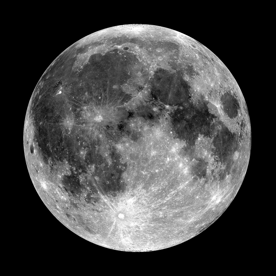
Featured Images
Dome Alone: A Lunar Mystery Near Herodotus Crater
The Herodotus Omega dome rises gradually above the surrounding mare. The large, irregularly shaped depression towards the right is likely a summit pit. Image width is 7.5 kilometers, centered at 20.25°N, 309.93°E [NASA/GSFC/Arizona...
Published on 16 Jul 2025
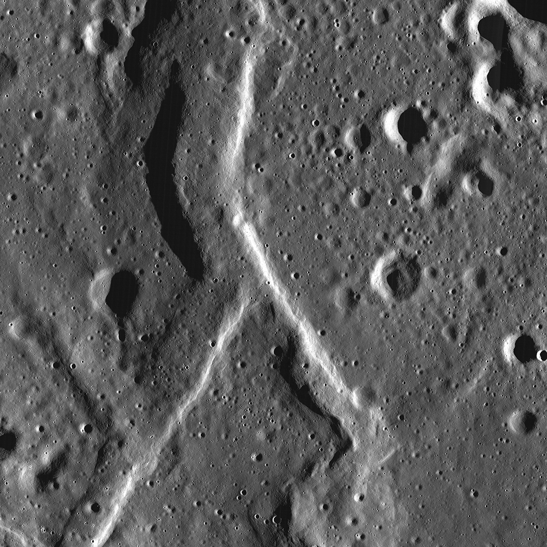
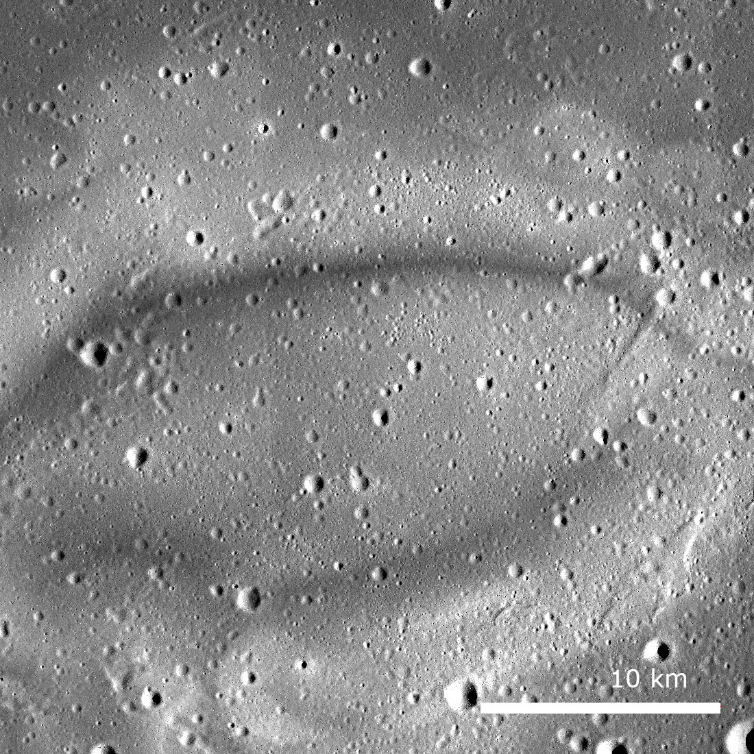
Fork in the Road
A forked wrinkle ridge (6.10° N, 347.74° E) branches into two segments. NAC controlled mosaic containing images M1365971178LR and M1365964142LR. North is up and solar illumination is from the east; the crater just to the west of the...
Published on 09 Jul 2025
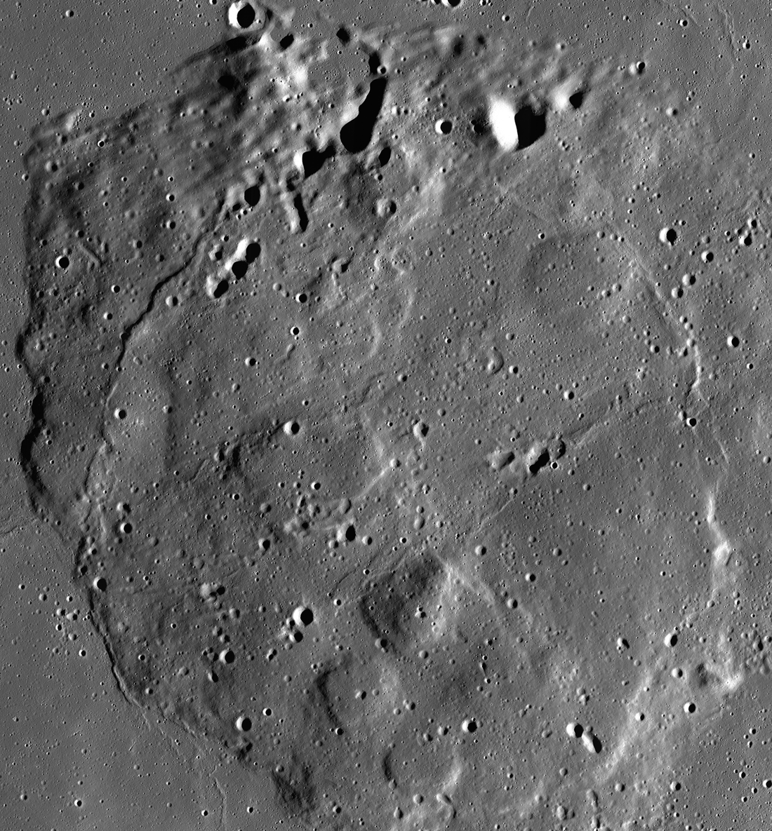
Mons Rümker and the Moon's Volcanic Past
NAC regional mosaic composed of 10 images showing Mons Rümker and the surrounding mare surface. Images acquired between 2012-06-03 to 2016-04-21. Image width is 299 kilometers, centered at 40.80°N, 301.43°E [NASA/GSFC/Arizona State...
Published on 12 Apr 2025
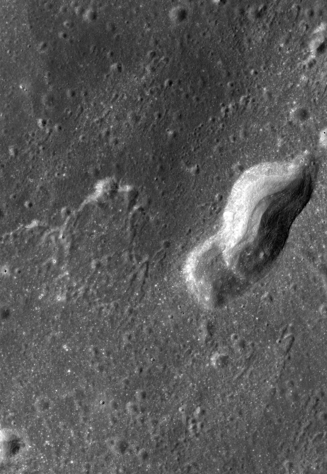
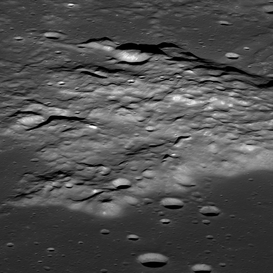
Gruithuisen: Collapsed Lava Tube?
The spectacular sinuous landform shown above is thought to be a collapsed lava tube (34.7°N, 316.6°E), located near Gruithuisen K crater. NAC controlled mosaic containing images M1173350480L/R, M1173357586L/R [NASA/GSFC/Arizona...
Published on 06 Oct 2023

Silicic Volcanoes on the Moon
The silicic volcano Mairan T (41.79°N, 311.61°E) stands over 600 meters tall and in stark albedo contrast to the surrounding dark mare basalts of Oceanus Procellarum. The view is from west-to-east, scene is 6.6 kilometers wide, NAC...
Published on 11 Oct 2022
Reiner Gamma: Swirling in Mystery
Reiner Gamma lunar swirl (7.5° N, 301.0°E); NAC controlled mosaic containing images, M1139307518L/R, M1139300406L/R, M1139286182L/R, M1139293294L/R, and M1108661104R [NASA/GSFC/Arizona State University].
Published on 26 May 2022
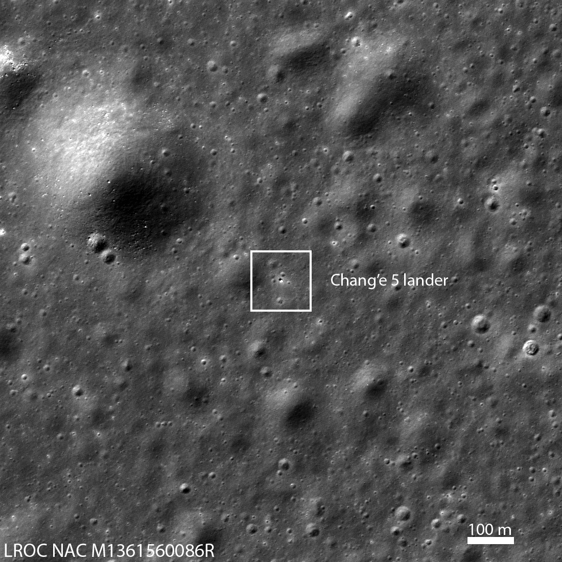
First Look: Chang'e 5
Box indicates Chang'e 5 lander on the basaltic plains of Oceanus Procellarum ("Ocean of Storms") on 02 December 2020 09:54 EST (14:53:55 UTC). The lander is the bright spot in the center of the outline. Image is 1210 meters wide; north...
Published on 04 Dec 2020
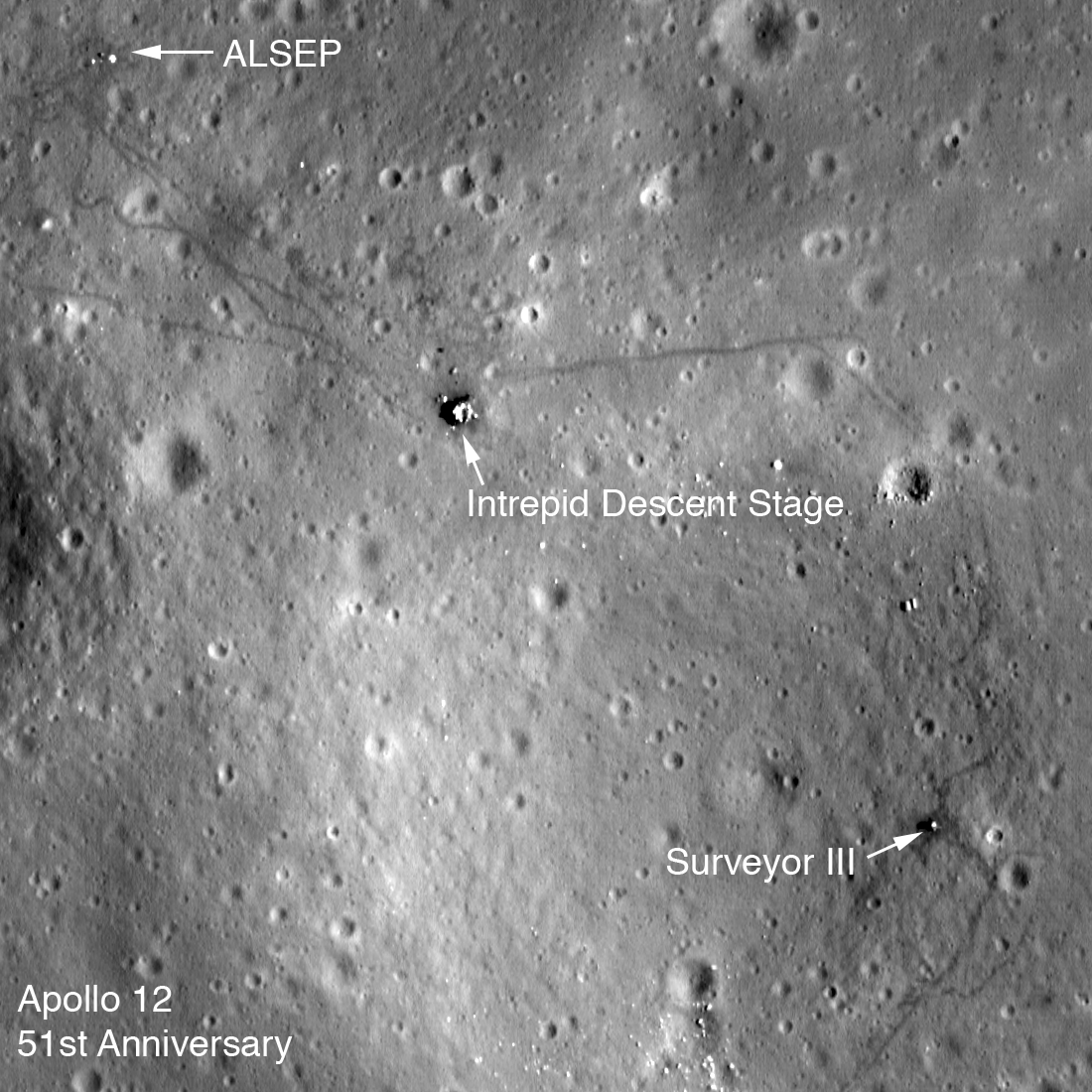
Apollo 12 Fifty-first Anniversary
LROC low-altitude image of the Apollo 12 landing site. The Lunar Module descent stage, Apollo Lunar Science Experiment Package (ALSEP), and Surveyor III spacecraft are all visible along with astronaut tracks. Image is 275 meters wide,...
Published on 13 Nov 2020
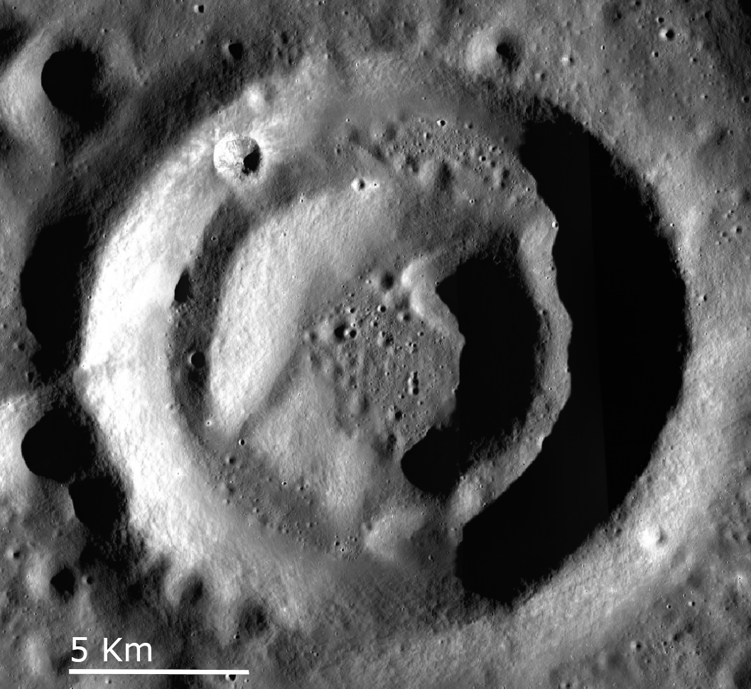
A Lunar Donut: Bell E Crater
Bell E Crater (22.06° N , 264.06° E; ~16 km diameter) controlled feature mosaic made from images M1139534784L/R & M1139527672L/R [NASA/GSFC/Arizona State University].
Published on 02 Oct 2020
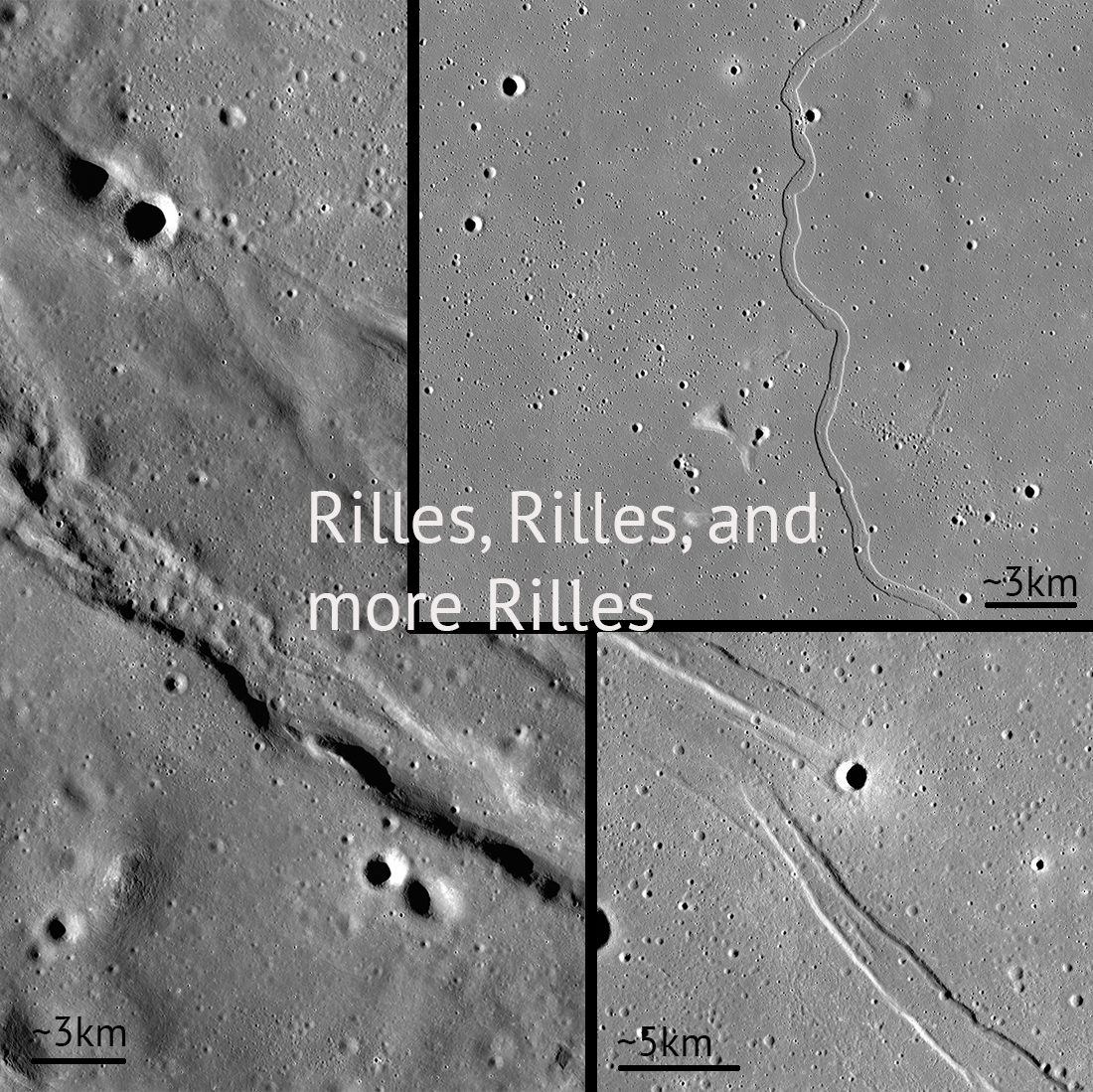
Rilles and Rilles: Sinuous, Straight, and Arcuate
Rilles are all over the Moon! Controlled feature mosaics help us see these features with great detail. Pictured: Rimae Sulpicious Gallus (20°N Lat, 10°E Lon), Rima Sharp (46°N Lat, 309°E Lon), Rima Cauchy (10°N Lat, 38°E Lon)...
Published on 30 Apr 2020
"Oceanus Procellarum Base Here - The Eagle Has Landed"
In 1969, NASA published a map showing candidate Apollo 11 and Apollo 12 landing sites. The map was based on photographs taken using large Earth-based telescopes. The map above, based on an LROC global image mosaic, is a near-copy of...
Published on 09 Aug 2019
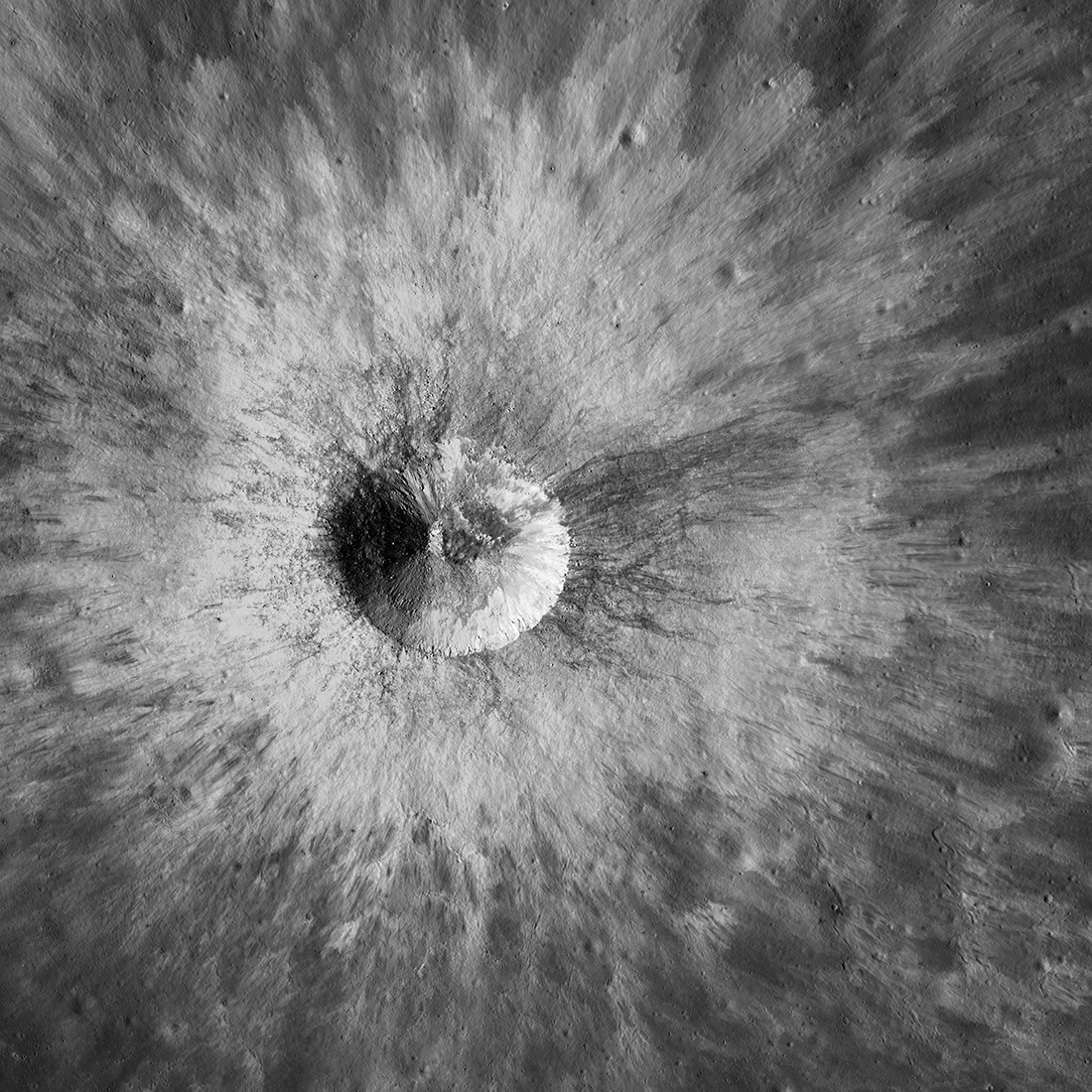
Lunar Beauty
The Lunar Reconnaissance Orbiter Camera imaged this bright young ray crater (3.13˚N, 281.07˚E) on 3 November 2018 — just three weeks ago. The Sun shone from the west (left, 48˚ incidence angle). This image covers an area 8.1 kilometers...
Published on 21 Nov 2018

Aristarchus Crater
The Aristarchus crater (40 kilometer diameter, 23.73°N, 312.51°E) and plateau is one of the most geologically complex areas on the Moon. In this amazing picture, the LRO spacecraft slewed 62° (west-to-east) looking across the crater....
Published on 04 Aug 2018
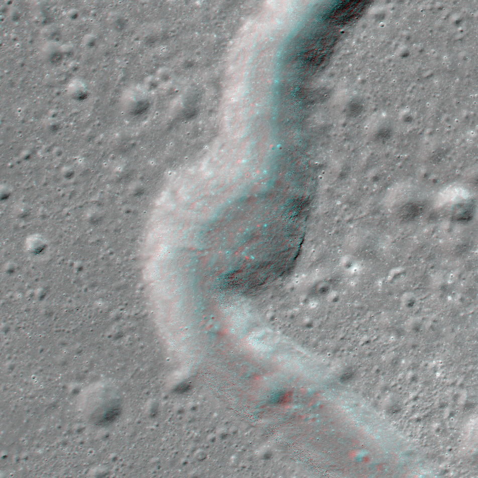
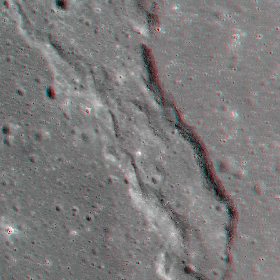
NAC Anaglyph: Rima Sharp
A bend in Rima Sharp, a sinuous rille that can be traced more than 250 km and spans the boundary between mare-filled Sinus Roris (to the north) and Oceanus Procellarum (to the south) [NASA/GSFC/Arizona State University].
Published on 26 Jan 2018
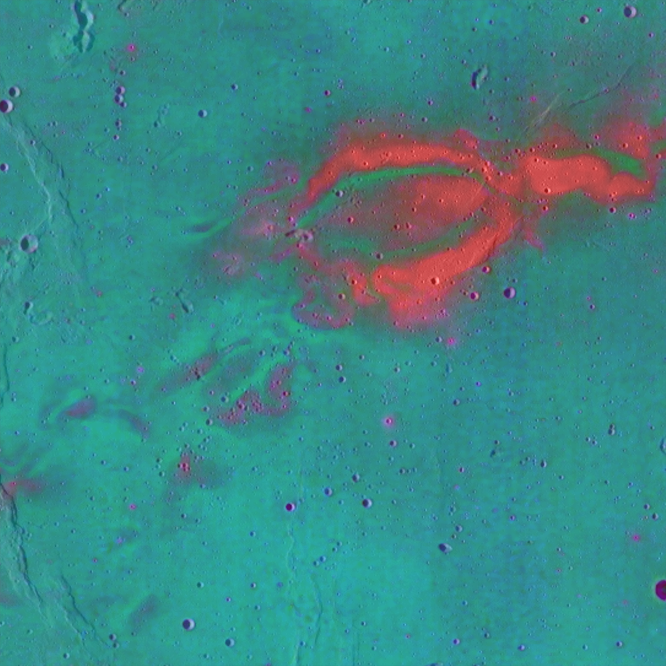
Ilmenite Seen with Ultraviolet Light
The low-reflectance portions of the Moon are composed of mare basalts, which formed via large eruptions of lava in the ancient lunar past. Variations in reflectance within the mare depend on composition, in particular, the abundance of...
Published on 01 Dec 2017
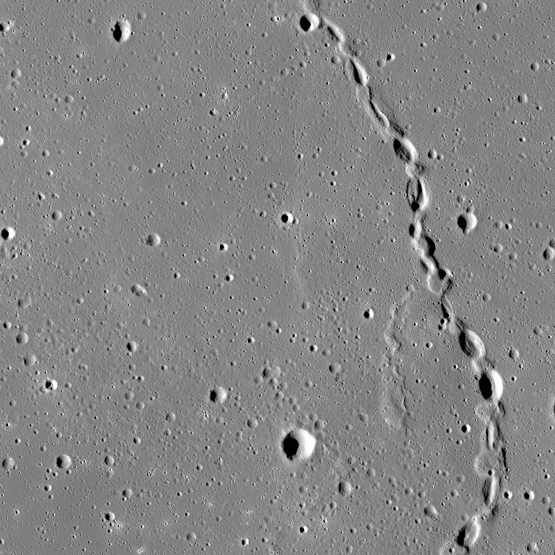
NAC Anaglyph: Dorsa Whiston
A distinctive wrinkle ridge in Oceanus Procellarum named Dorsa Whiston. Ridges like this one result from substantial compression within portions of the lunar maria [NASA/GSFC/Arizona State University].
Published on 12 May 2017
Mons Hansteen: A Window into Lunar Magmatic Processes
Oblique view of Mons Hansteen, located near the southern margin of Oceanus Procellarum at 12.3° S, 309.8° E. This enigmatic landform is thought to be a volcanic complex and one of only a handful of known sites on the Moon composed of...
Published on 10 Apr 2017
Swirls Across the Moon
The swirls of Reiner Gamma, shown in enhanced color (415 nm, 321/415 nm, 321/360 nm in red, green, and blue, respectively) from the LROC Wide Angle Camera, overlaid on a monochrome mosaic. Scence is 108 km across and centered at 6.6° N,...
Published on 03 May 2016
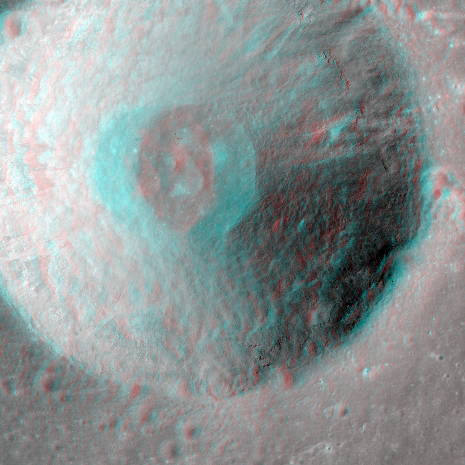
LROC NAC Anaglyph: Herodotus A
Herodotus A - a nice bowl-shaped crater in Oceanus Procellarum [NASA/GSFC/Arizona State University].
Published on 19 Jun 2015
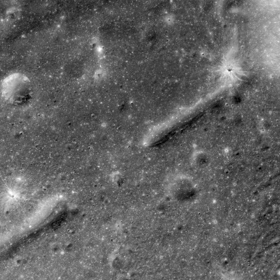
Exploring the Lunar Subsurface
What a great place to explore! Two collapsed segments of a lava tube run from the southwest to the northeast. These collapsed segments may provide access to the subsurface, which has never been directly sampled. The average width of the...
Published on 05 Nov 2014